Hill, Spring, Chapel: Notes on Kremesnik
~ Saturday, May 14, 2022 ~
Křemešník rises to 769 metres above the Pelhřimov valley and carries mixed forest to its summit. It is the highest point in its subregion of the Vysočina highlands. The hill has a spring, a founding legend involving a flooded mine shaft, and a Baroque pilgrimage church that was built on the site of a Gothic chapel that was built on something older, as these things usually are.
Elena walked up from the south in early May, before the main pilgrimage season. The beech forest was still in leaf-break, the understorey open enough to read the ground. The Vysočina highlands in this part of Bohemia are rolling country: forested hills separated by narrow valleys with small streams and scattered ponds, the agricultural strips thinning as you climb. Křemešník sits above all of it. On a clear morning you can see the Pelhřimov basin to the northwest and the first hills of the Moravian borderland to the east.
The approach from the south follows the edge of the mine workings. Křemešník was a silver-mining site from at least the fifteenth century. The mines flooded and were abandoned before 1555, when a citizen of Pelhřimov named Matouš Chejstovský fell into one of the old shafts, survived, and built a wooden chapel on the hill as an act of thanksgiving. The chapel and the mine are connected at the beginning: the founding legend is a story of going underground and coming back up.
The spring
The Stříbrná studánka — the Silver Spring — is not at the summit. It sits on the lower slope, roughly halfway between the valley floor and the crest, near a hunting lodge that appears on older maps as Korce. The spring issues from the same silver-bearing ore formation as the flooded mines, making the water faintly mineral and, according to measurements Elena has seen cited in pilgrimage literature, slightly radioactive.
The chapel of St. John the Baptist stands at the spring. It was built in 1689 — earlier than the summit church — and the Stations of the Cross begin here, linking the spring to the summit in a processional route that is older than any of the current structures. The spring chapel is small, whitewashed, its walls flush with the cut stone of the surrounding terrace.
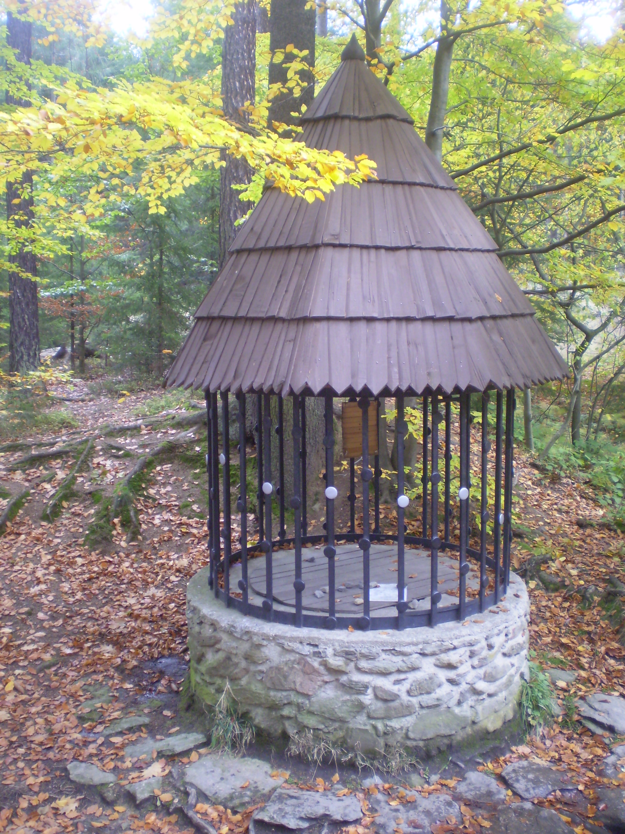
Healing springs associated with mineral water are among the most persistent features in the European religious landscape — persistent across changes of practice, language, and formal belief. The Stříbrná studánka has a documented history of pilgrimage use from the seventeenth century, and the spring itself is older than that history. Pilgrimage documentation begins when institutions begin recording; the water does not.
The summit
The Church of the Most Holy Trinity at the summit was built between 1710 and 1720, replacing the chapel Chejstovský founded in 1555. The 1555 structure was Gothic; the present church is Baroque, with a three-sided cloister arcade and a pair of side chapels. The church guide notes the older foundations without elaborating on what they are or how far down they go.
The summit commands a wide view. On the morning Elena was there, the valleys were still in morning shadow and the forest ran unbroken to the horizon in three directions. The hill is the kind of place that draws attention from a distance and holds it at close range. Whether the 1555 chapel found it significant or made it significant is a distinction that landscape does not observe.

The phrase that fits
In apocryphal apostolic literature and in the hagiography of the Irish and Celtic wandering monks, the destination of the missionary who travels beyond the edge of the known world is often described in similar terms: a place where the forests are dense and the springs are holy. The phrase varies by text and by century, but the landscape is consistent. It is a place set apart by natural conditions — height, water, woodland — rather than by human designation.
The Vysočina highlands fit this description without any adjustment. The Křemešník hill specifically — prominent in its subregion, forested to the summit, with two documented springs and a third implied by the mining geology — fits the description with a precision that Elena did not expect when she read it the first time.
This is not an argument for anything. Landscape types recur across large geographic areas, and a description that fits Křemešník also fits several dozen hills in Bohemia and Moravia. What Elena is recording is the fit, not a conclusion about what caused it.
A mark
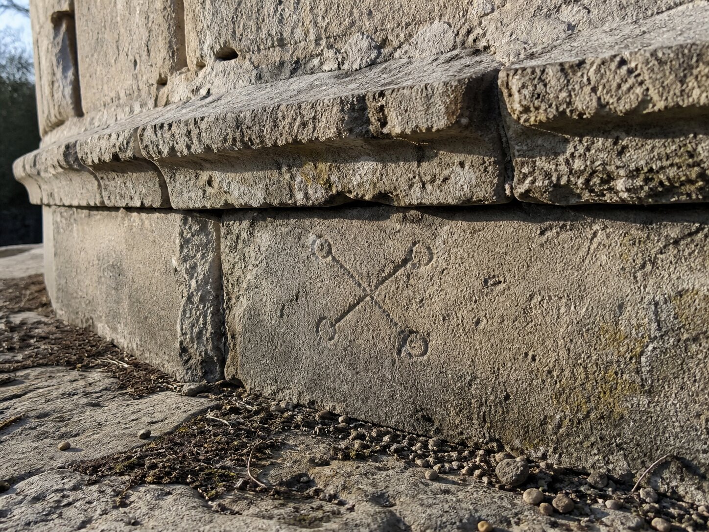
While photographing the base of the lower chapel wall at low angle — the morning light was raking across the stone — Elena noticed a carved mark on the foundation course, set back beneath the sill. Two crossed lines with small circles at each end, eight or nine centimetres across, incised shallowly into the limestone. It is worn to the point where it is only legible from certain angles and in certain light. It does not appear in the chapel’s published iconographic documentation.
Elena does not know what it is. It is consistent in scale with a stonemason’s mark, but the form — the circles at the terminals — is not typical of the mason’s marks she has seen catalogued from the region. It is consistent with an apotropaic mark of some kind, but she has not found a parallel. She photographed it from three angles and will pass the photographs to anyone with a specific reason to examine them.
Whatever the chapel replaced, it was not nothing. The hill was chosen for a reason that these structures inherited rather than invented. What that reason was, the documentary record does not say.
The landscape says something, but landscape is not a document, and Elena is careful about what she claims it proves.
Sources
- Wikipedia — Křemešník (elevation, chapel history, founding legend, spring, mining history)
- VisitCzechia — Křemešník Educational Trail (landscape and trail network)
- World History Encyclopedia — Sacred Sites and Rituals in the Ancient Celtic Religion: worldhistory.org (hilltop and spring veneration in Central European Celtic territories)
- Medievalists.net — The Christianisation of Bohemia and Moravia: medievalists.net (Christian overlay on pre-Christian sacred sites in the region)
Wednesday, May 18, 2022
I walked the same approach from the south in autumn a couple of years ago. The raking light detail rings true — the lower chapel wall is heavily worn and that foundation course would be invisible in flat afternoon light. I photographed the wall myself but at the wrong angle and wrong time of day. If you’re willing to share the photographs I’d be glad to have a look. I have some familiarity with mason’s marks from the region though not enough to say anything definitive about the terminal circles.